Encouraging 2 Way Communication With Multiple Feedback Pathways


PLB Resistant clone
Getting feedback on a project's progress or maybe operating a helpdesk ... particularly for rural development projects or in areas with limited communication options ...It is essential the target stakeholders can let us know about progress, how well we are supporting them, and any emerging issues ... and ask the questions needed to get themselves going. Not everyone has the access, or knowhow, or maybe are simply uncomfortable in using a particular methodology.. or technology, for giving us the feedback we need. Flexibility in a system will allow manual addition of adhoc face-2-face, post (snail mail) and telephone enquiries, as well as data from formal surveys and adhoc web portal, SMS, email, and social media inputs. A web based system can provide all this ... and automated collection and collation of the electronic sources ....
Continue Reading 0 Comments

Version 2 citation friendly bibliography database


New interface for the online library Version 2


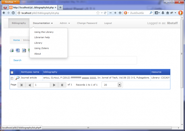
Version 2 of the online library is now well on the way. with a fully functional framework in place for testing.  This update has implemented a completely new backend, based on the PostgreSQL database, a new interface with popup previews, and a number of other new features and improvements. The attached images give a preview of the things to come, albeit showing "dummy" test framework data. The library component of the  version 2 development version can be seen here.


Continue Reading

Creating a citation friendly bibliography database


Online library system
2013 gave me an interesting and challenging few months learning and building an online reference / bibliographic database (mainly in my spare time). I had some basic criteria: low cost, easy to learn and use, easily able to import and export data, library standards compliant, zotero friendly, incorporate basic libray functions, provide full text access, submission queues,  and allow multiple user access with differential security levels. First I looked at "off the shelf" products and of a multitude of these, Refbase, EPrints, and Koha stood out as candidates. I really liked Refbase, and it ticked most of the boxes, especially with regard to citation, but sadly, lacked flexibility in fields and library functions and needed extra steps to convert our spreadsheet based data for import. Similarly, EPrints did not stand up to the reputation.  Koha, on the other hand, is a full blown integrated library system. It ticked all boxes except for ease of use and import of data...and ease of adding uploaded "full text" files.  In the end, it was possibly too comprehensive, and while much effort was spent in migrating to the MARC standard, the difficulties in handling multiple authors in a Zotero friendly way, led me to look at an alternate path.

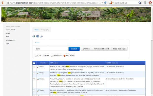
I had been reluctant to build a system from scratch, as even though it would give the flexibility we needed, the need to build in metadata harvesting by Zotero was a whole new learning curve!   Take a look at the end product - a fully functional copy of the system (without the full text attachments)  is available here on Digging Stick.

Continue Reading

Building a Google Maps Application with PostgreSQL


Google Map
How to save points from Google maps in a PostgreSQL database. This has been adapted from 2 articles for MySQL, referenced from The Google Geo Developers Blog -

New Articles: Powering Maps API v3 Apps with MySQL

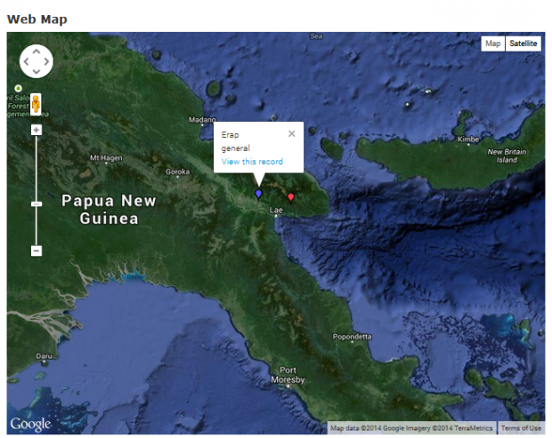
"Using PHP/MySQL with Google Maps" shows how to pull data from a SQL database as XML and display that on the map.

"From InfoWindows to a Database: Saving User-Added Form Data" shows you how to enable users to add geo-tagged information to a database via your map application.


Migrating this to PostgreSQL was worth the effort as it opened opportunities to integrate the Google Maps application with PostGIS.  See Google Maps (API 3) application and related story: Getting Productive With QGIS, Postgresql, PostGIS, and Google maps

The following code snippets give examples of the PostgreSQL adapted code - no other changes are needed from the referenced articles. Learn more about this in our online training module - Getting Productive with (Q)GIS

Continue Reading

Getting Productive With QGIS, Postgresql, PostGIS, and Google maps


QGIS
QGIS is a great GIS program.... and free .... and open source ,,,, and cross platform .... and .... 

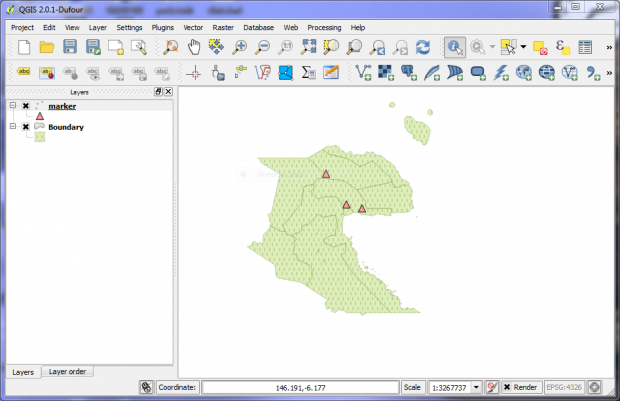
Besides the inbuilt capabilities, its extensibility through plugins makes it a very powerful tool. -  Having not used the system before, I wanted to give it a test to see if it could stand up to the claims and how easily it could do the tasks I needed. - While QGIS has several ways to achieve a similar result, including direct incorporation of Google and other maps providers with the 'Openlayers' plugin, the first test was to take points captured (in an external Postgresql database) from Google Maps, and add these points as a PostGIS layer in QGIS.

Bottom line:  I am impressed !

Continue Reading